Editor's Note: The following is a guest post from Stantec's urban planning and design principal Cynthia Albright and transportation project manager Brandon Orr.
Crises have a way of putting mundane things we normally take for granted under a microscope. The COVID-19 pandemic has given birth to a hectic, unpredictable situation that has manifested itself in unexpected ways.
Case in point: The threat of diminishing access to goods led to a scarcity of toilet paper, and the closure of restaurants resulted in personal stockpiling and empty shelves at grocery stores.
In a wide-reaching pandemic, natural disaster or other significant emergency that derails transportation systems, communities lose essential lifelines. As the world copes with COVID-19, the safe delivery of freight, food and hospital supplies is imperative to keep people alive.
To ensure resiliency through unexpected crises, communities need to examine and eliminate isolation factors — circumstances or influences that might limit access to the supply chain. In our current situation with COVID-19, necessary supplies simply don’t exist to meet the demand. Our former global supply chain became a single stream in the blink of an eye.
While our normal global supply chains are being strained, communities need to take a hard look at where their necessities come from, and how they are delivered. Resiliency takes planning. It's critical that we continue to have a lifeline to the freight deliveries we need to support society’s basic and fundamental needs.
Data has an enormous role to play here, yet few communities are aware of the value of data as a tool in understanding their freight transportation systems. Using data to identify isolation factors, find alternate routes and ensure flexibility in the transportation system can help get supplies to people when they’re needed.
Small disruptions can become large disruptions
Is there a single primary route that brings goods into your community?
We’ve seen instances where large snowfalls impact highways over mountain passes, which affects the delivery of goods to certain areas. For example, I-80 crosses the United States from San Francisco to Teaneck, NJ. This single highway connects markets to the supply of goods that arrive via the Port of Oakland. Average snowfall at the peak of I-80 near Truckee, CA, exceeds 200 inches per year. So naturally, there are many winter days and evenings where trucks are held on one side or the other until it is safe to cross.
Research has long tied inclement weather to highway bottlenecks. And while communities can withstand delays in delivery of essential goods for a few days, these delays cannot last for a long period of time.
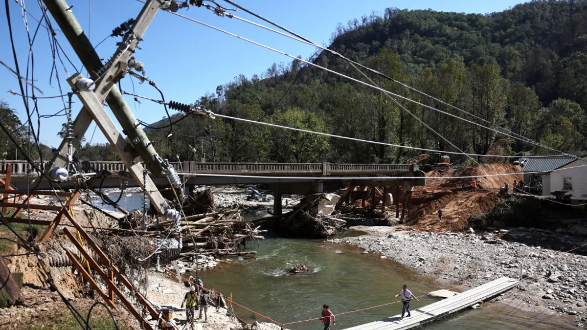
Similarly, if there's a bridge on the one roadway that acts as a supply line, and that bridge fails, wide-ranging impacts are a certainty. When Ontario's Nipigon River bridge failed in 2016 — severing the Trans-Canada Highway, and the connection between Manitoba and Ontario — all commercial traffic was rerouted through Minnesota and back around to Ontario. It's been estimated that 1,300 trucks carrying $100 million worth of goods take this route daily.
A month and a half after the failure, the bridge opened to two lanes of traffic, with all four lanes available again two-and-a-half years later. Considerable congestion and delays to truck traffic resulted in potentially significant impacts on air quality and the natural environment. Further, the additional costs of the freight delivered was passed on to the consumer.
Local and regional authorities need to take a holistic view to freight planning. While a single bridge or roadway may have the capacity to support routine truck volume, that one link is fragile and presents a risk to the entire network.
Secondary routes and isolation factors
What can we learn? Here’s the first thing: plan for the unexpected.
To maintain the health and safety of their residents, communities should begin pre-planning alternative routes to maintain resilience for future worst-case scenarios. In areas where the potential for isolation is significant, planning actions can be taken now to help communities build flexibility and reliability into their transportation networks.
Many of the principles we apply in planning for vehicles, transit and active transportation can be tailored to the goods movement context. For instance, during the development of a transportation master plan in Orillia, a suburb of Toronto, isolation areas for active transportation were identified, resulting in a recommendation for a new active transportation highway crossing. The same type of approach can be used for freight planning.
Communities need to examine their isolation factors, if any, and alternative route options built into their transportation network. COVID-19 has taught us all the importance of freight reliability and this should be forefront in the mindset of municipal agencies today. If agencies can reduce the stress of uncertainty related to freight delivery, then the fear of losing access to essential goods will be one less concern for community leaders.
How data can help
Location data from mobile devices has been used for years to inform numerous transportation planning efforts on behalf of municipal agencies. Most trucks transporting freight are equipped with smart devices for GPS tracking, and the trucks can be isolated from the general population of GPS tracking devices in several ways to map and visualize the transportation routes of all freight deliveries serving individual communities.
By geofencing an area, software flags all mobile devices entering or leaving. These deliveries can be tracked by point of origin using a combination of U.S. Census NAICS data (the North American standard for identifying goods), zoning maps and assessment information to isolate trucking operations. This information, coupled with other tools, provides a high degree of certainty that the location-based data is freight specific. Origin-destination information can then be used to explore other routes to develop alternative networks.
Most municipalities haven't considered doing this, nor are they aware that you can. Using data to analyze freight movement is both understudied, and relatively inexpensive to do. Freight has different needs and requirements than other modes of transportation and it’s necessary to quantify that difference to address community and business concerns.
Freight is typically planned to enhance operational safety and efficiency. New technology is available to address the safe delivery of goods from large trucks to neighborhood destinations but only if the large trucks can get to the communities in the first place. In the event of a crisis, that is not a certainty.
Providing flexibility
Municipalities need to build flexibility into the movement of goods planning now more than ever. They need to be strategic about identifying and developing alternative freight delivery options to create community resiliency, ensure food security and build public trust in leadership.
Make sure your community is as resilient as possible in the event of a natural disaster, unnatural disaster or a future pandemic. It’s imperative to address the reliable movement of goods via freight now so that we may be swift in addressing issues at the worst of times.
To keep up with all of our coverage on how the new coronavirus is impacting U.S. cities, visit our daily tracker.


