Dive Brief:
- Leica Geosystems, a division of Stockholm-based digital reality technology company Hexagon, released a new tool last week that has the potential to help cities become more sustainable and maintain existing infrastructure by speeding up the process through which they can create digital twins, according to Michael Lettau, vice president of business development for Leica’s reality capture division, and architectural experts that have used the product.
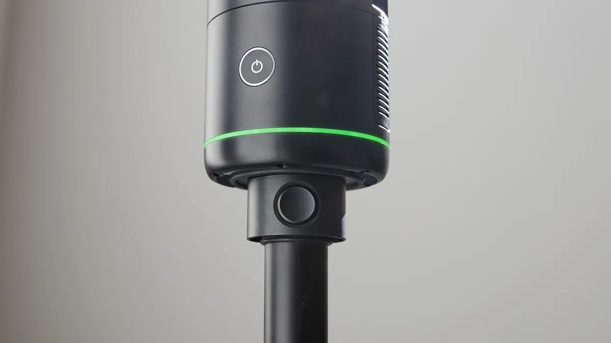
- The product is the second generation of Leica’s BLK360, a small device that quickly scans the surrounding area and generates data for use in digital twins.
- Many U.S. cities have already embraced digital twins as part of their sustainability efforts. Lena Geraghty, director of sustainability and innovation at the National League of Cities’ Center for City Solutions, said the technology gives municipalities “a new sense of flexibility and understanding.”
Dive Insight:
Digital twins – simulations of real-time data from physical objects or systems that can aid decision-making through virtual testing – have been proven to hold much value in city planning, including when it comes to sustainability.
A Los Angeles pilot plans to make the city’s buildings more sustainable and reduce carbon emissions using a digital twin. Chattanooga, Tennessee also uses a digital twin to anticipate and alleviate vehicle congestion in an effort to increase the energy efficiency of the city’s traffic. And it seems the trend will continue to grow. A recent report predicted that digital twin implementation will increase an average of 36% over the next five years in major industries.
Despite its utility, the technology requires much time and effort to develop, especially if it incorporates extensive, complex datasets. Conversations about creating a 3D model of Boston, for example, began in 2005 and only came to fruition 10 years later.
Leica’s latest BLK360 model won’t make this process instantaneous. Its high-speed scanning, however, could help alleviate some of the heavy lifting and its ability to share data in real time could aid collaboration, according to Lettau. One scan on the latest iteration of the BLK360 takes an average of just 20 seconds to complete, according to its technical specifications.
At a cost of approximately $22,000 and up, the BLK360 is less expensive than higher-end devices like Leica’s RTC360 surveying tool, but far more accurate than cheaper products such as smartphone scanning apps, said Corey Weiner, founder of Boca Raton, Florida-based company c2a.studio, which digitizes data of existing structures and uses the product.
The BLK360 can also be used to increase sustainability in cities. Lettau pointed to possibilities such as not having to open an entire street to repair a sewer or getting precise measurements when cutting drywall to reduce waste.
Nick De Pace, an architect who teaches at the Rhode Island School of Design, has used the first generation of the BLK360 to uncover and map ancient water systems dating to Roman times in an effort to help cool the city of Naples, Italy.
“I think the issue is trying to understand what’s there, understand the way this water is, where it finds itself urbanistically, and start to think about large-scale ideas about green spaces and blue spaces that can cool down cities,” he said.
De Pace explained that a lot of water in these ancient systems has been cut off from public use over health concerns, but hopes that it can be redirected to cool down the city’s heat-trapping surfaces or to irrigate green spaces, for example.
Geraghty, of the National League of Cities, agreed that digital twins, such as those built with the help of the BLK360, are valuable for cities. She pointed specifically to the increased information they can provide, which could enable cities to make informed decisions about how to recover from a natural disaster, for example, or to determine the implications of planned construction.


